Grassy Cove, North America's Largest Sinkhole
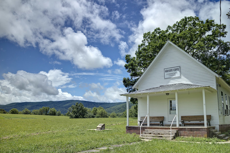
Grassy Cove Community Center with Brady Mountain visible behind it.
Nestled in the southeastern part of Cumberland County, Tennessee lies a quiet community known as Grassy Cove. Its flat fertile land is home to agriculture and scenic farms which are still owned by the descendants of the first European inhabitants of the area.
Without looking more closely at the landscape, it might escape the casual viewer that one was sitting inside a giant bowl. But with the aid of maps, it becomes readily apparent that Grassy Cove isn't like any old hollow.
My first rule as a photographer/geographer is "Ask a local". Locals know a lot. For example, it's long been known that if it rains too much in Grassy Cove, then the fertile bottomland turns into a lake. It's also known from the days of yore that discarded corn shucks in the cove will appear in the Sequatchie River a few miles away, a few days later. What's going on here?
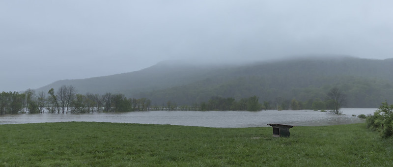
Grassy Cove flooded.
Structurally, there's a lot to be said about Grassy Cove; it's not just a simple sinkhole. Its formation is the middle stage of a grand weathering process, with hints of its beginning and end observable along the axis of Sequatchie Valley Anticline, a giant geomorphological feature that spans two states. The Sequatchie Valley Anticline is a remnant of the same compressional forces which created the ridges and valleys in the physiographic province of the same name east of Grassy Cove. The Sequatchie Valley Anticline is a huge structural deformation where the bedrock was folded. Imagine a carpet getting scrunched up; the spots where it bends upwards are anticlines, downwards are sinclines.
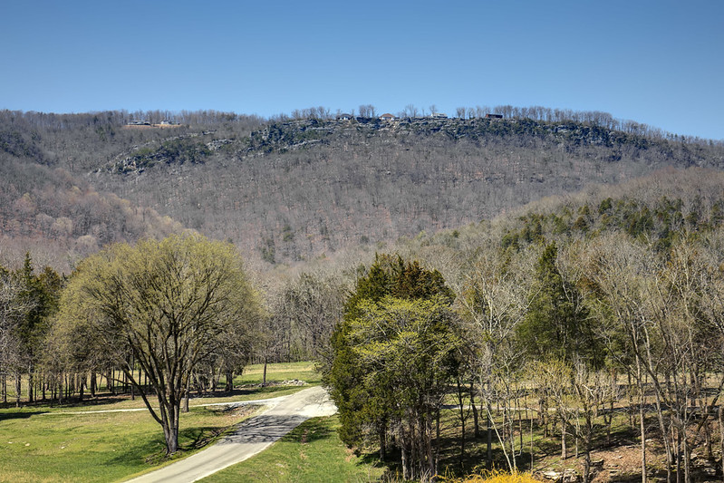
Sequatchie Valley Anticline clearly visible from this northern locaiton.
The anticline has been around for a really long time, slowly being weathered away. The erosion process means that it is retreating northeasterly following structure, so features at its northern extent may offer a glimpse into what happened further south longer ago. In other words, the things we see in Grassy Cove now offer clues to the previous state of the Sequatchie Valley. Conversely one can forecast what Grassy Cove will become by looking at how the Sequatchie Valley is now.
Grassy Cove is drained completely through a cave system. Its water emerges at Devilstep Hollow, the head of the Sequatchie Valley.
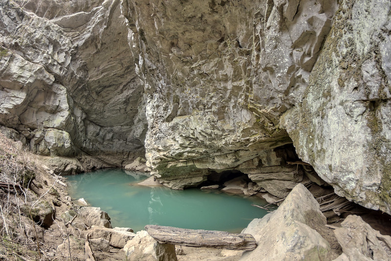
Devilstep Hollow, Head of the Sequachie Valley.
As stated, this is the largest sinkhole in North America (which I am aware of). Back in 2013 Tom Dunigan and I crunched some numbers for sinkholes in Tennessee. I made areal and volumetric estimates based on 10m Digital Elevation Models (DEMs). Now, 2.5' DEMs area available, which are 172 times more detailed than the 10m DEMs. I wanted to make a renewed comparison and try to tease out more detailed information.
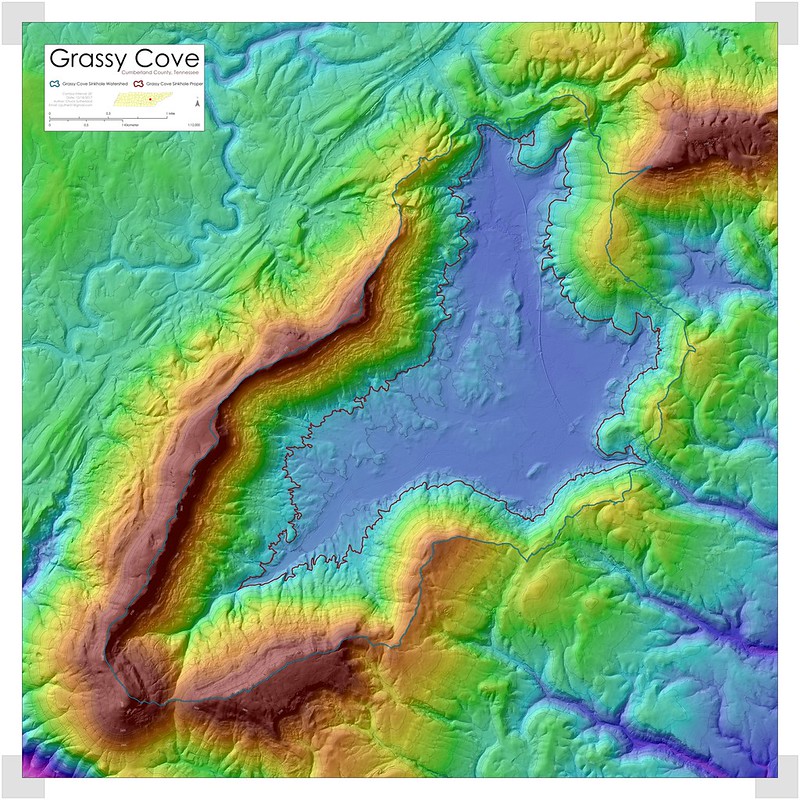
Lidar Map of Grassy Cove.
Below are the updated figures for the region based on the 3DEP lidar.
| Region | Measure | Value | Unit | |
| Watershed | Area | 33.17 | Kilometers2 | |
| Watershed | Perimeter | 42.15 | Kilometers | |
| Sinkhole | Area | 13.31 | Kilometers2 | |
| Sinkhole | Perimeter | 35.71 | Kilometers | |
| Sinkhole | Major Axis | 7.67 | Kilometers | |
| Sinkhole | Minor Axis | 4.36 | Kilometers | |
| Sinkhole | Axial Declination | 30.80 | Degrees | |
| Sinkhole | Minimum Elevation | 467.27 | MASL | |
| Sinkhole | Maximum Elevation | 507.24 | MASL | |
| Sinkhole | Depth | 39.97 | Meters |
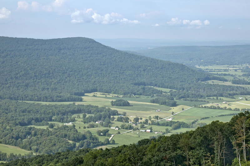
Looking northeast from southwest rim at approximately 35.800097, -84.962180.


Comments