Cave Locations on the Internet
As any conservation minded individual will tell you, having a cave location be public knowledge is usually a recipe for disaster. It's a very well documented phenomena that people break cave formations, vandalize caves with spray paint and other mediums, and leave gross amounts of trash behind. Even well meaning hikers and outdoors people may not realize the nuance of landowner relations and by accessing private property may upset relationships that cavers have worked hard to develop so that we may have access to caves.
The proliferation of geodata in many accessible forms is eroding the secrecy that the caving community has long used to protect underground resources. Here's a guide with suggestions on how one can protect these sensitive places from occuring on Internet.
The first thing to realize about Google maps is that deleting a feature is nearly impossible. It's possible to "take ownership" of a feature if you claim it as a business, which involves recieving some mail from Google and plugging in some numbers they mail you. The easiest method I have found to manage a feature on Google Maps is as follows.
1) Locate the feature.

2) Suggest and edit.
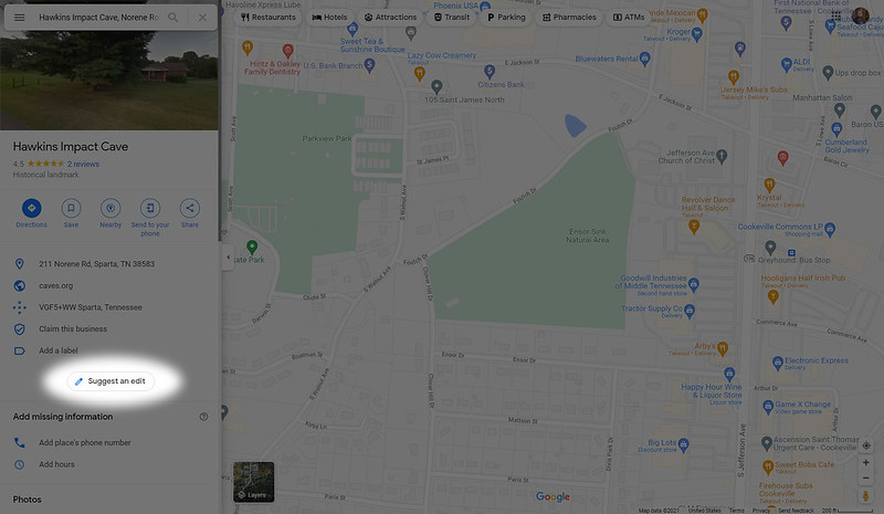
3) Change name or other details.

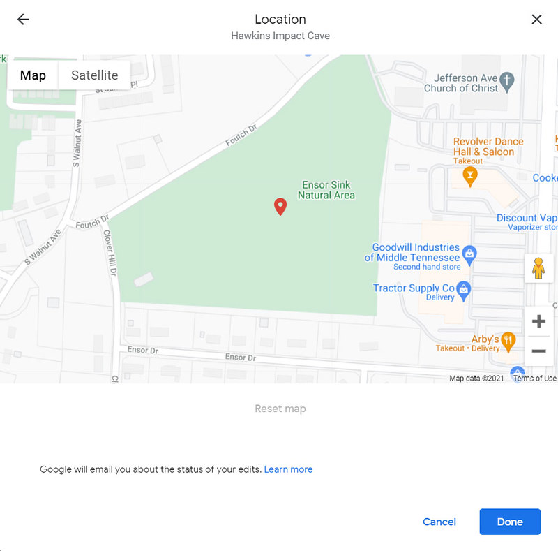
4) Update location on map.


5) Select a location that is meaningful.
Here I have chosen a local city park, Ensor Sink. A small cave is located there, and there is an interpretive kiosk with information about caves, hydrology, and conservation. It's a well developed resource which has values consistent with that of the caving community.
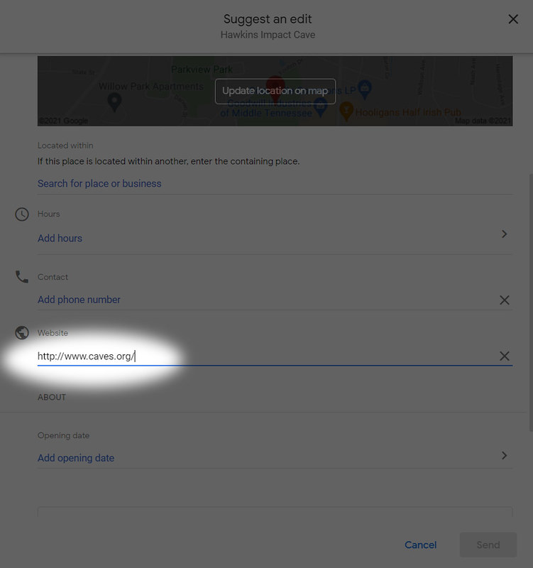
6) Update the Website.
I have chosen to update the website for the feature to that of the National Speleological Society so that people interested in caves will be more easily connected with the community.
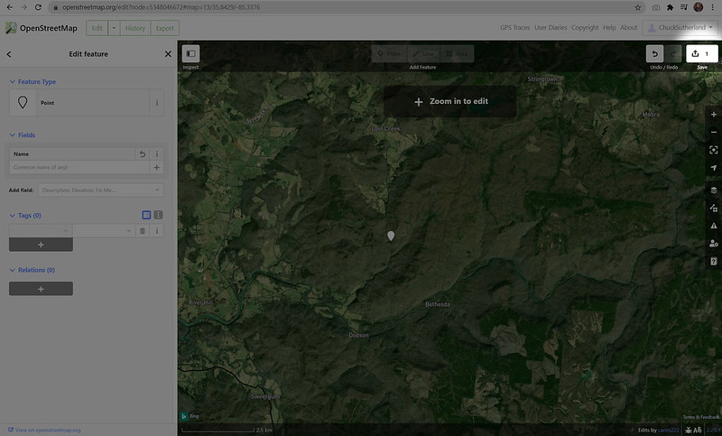
For this example I am going to use a feature on public lands, Lost Creek Cave. Because the location of this cave is so well known, and even publicised by its land manager, the State of Tennessee, I will not actually delete this feature from the map. This simple serves as an illustration on how one would remove a cave from OSM.
1) Log in
You will need to create an account with OSM if you do not already have one.
2) Locate the feature.

3) Select the feature by clicking on it.

4) Edit the feature.
Expand all attributes and use the trash can to delete feature name and any tags which exist.

5) Save your work. Click the save button in the upper right when you are done.
The proliferation of geodata in many accessible forms is eroding the secrecy that the caving community has long used to protect underground resources. Here's a guide with suggestions on how one can protect these sensitive places from occuring on Internet.
|
Jump to... |
The first thing to realize about Google maps is that deleting a feature is nearly impossible. It's possible to "take ownership" of a feature if you claim it as a business, which involves recieving some mail from Google and plugging in some numbers they mail you. The easiest method I have found to manage a feature on Google Maps is as follows.
1) Locate the feature.
2) Suggest and edit.
3) Change name or other details.
4) Update location on map.
5) Select a location that is meaningful.
Here I have chosen a local city park, Ensor Sink. A small cave is located there, and there is an interpretive kiosk with information about caves, hydrology, and conservation. It's a well developed resource which has values consistent with that of the caving community.
6) Update the Website.
I have chosen to update the website for the feature to that of the National Speleological Society so that people interested in caves will be more easily connected with the community.
For this example I am going to use a feature on public lands, Lost Creek Cave. Because the location of this cave is so well known, and even publicised by its land manager, the State of Tennessee, I will not actually delete this feature from the map. This simple serves as an illustration on how one would remove a cave from OSM.
1) Log in
You will need to create an account with OSM if you do not already have one.
2) Locate the feature.
3) Select the feature by clicking on it.
4) Edit the feature.
Expand all attributes and use the trash can to delete feature name and any tags which exist.
5) Save your work. Click the save button in the upper right when you are done.


Comments