Don't Drink Cave Water
It's becoming an almost daily routine that I feel obligated to share with people that they shouldn't drink cave water. This is me being lazy, so that I can simply point people to this essay in the future.
What do I mean by cave water?
Why shouldn't I drink water from a cave?
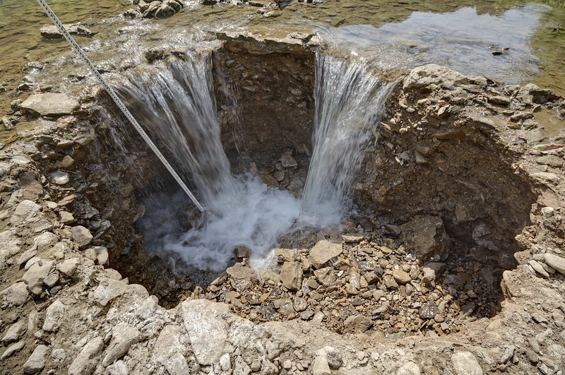
Recharge to karst aquifers bypasses the filtering capability of soil through macropores and swallow holes.
Water can be filtered through soils. However in many parts of karst regions there is little to no soil is present between the surface, and subsurface stream.
Groundwater flows through conduits so that there is little opportunity for filtration or sorption of contaminants onto aquifer material.
When water is able to flow through the grains of bedrock, the bedrock is able to filter and remove contaminants. In karst, the grains of the bedrock are dissolved and larger and larger conduits are created. Conduits, like caves, provide little, if any filtration of contaminants.

The movement of pollutants cannot be directly observed as in a surface-flowing stream.
In the system pictured below, there's a gap of several miles between where the water goes underground and returns to the surface.
Flow paths may take routes that are not apparent from the topography or slope of the land.
These are huge issues. If I were to show you the overlay of a cave map on a surface map, would you be able to tell me where the subterranean drainage boundaries are? As in, if this gas station's tank started leaking, would gas enter this cave?
Currently, our toolkit for delineating a subterranean drainage basin is very limited. And it turns out their boundaries don't behave like surficial watersheds. Their boundaries are often gray, fading into and out of one another. Their boundaries are affected by stage, or the height of the water in the system, which is often not able to be observed directly. In the map below, the flow lines of subterranean water are simply to show you their source, and where they surface at. They are not accurate.

Flow velocities in karst aquifers are fast compared to velocities in granular aquifers, allowing little time to warn downstream users following a reported spill.
This also means that if you got cave water tested yesterday and it was clean, it doesn't necessarily mean that it is today. Rapid contaminant transport is a major issue in karst regions.

Flow is in converging conduits; therefore pollutants are not diluted through dispersal.
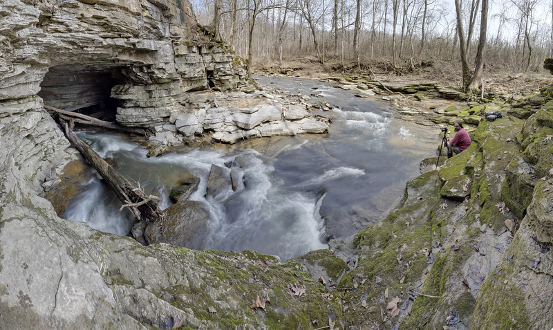
More accurately, I mean water from a karst spring, or cave. If you don't know what karst means, look here.
Sources:
http://karst.iah.org/karst_hydrogeology.html
https://www.uky.edu/KGS/water/general/karst/gwvulnerability.htm
What do I mean by cave water?
Why shouldn't I drink water from a cave?
Recharge to karst aquifers bypasses the filtering capability of soil through macropores and swallow holes.
Water can be filtered through soils. However in many parts of karst regions there is little to no soil is present between the surface, and subsurface stream.
Groundwater flows through conduits so that there is little opportunity for filtration or sorption of contaminants onto aquifer material.
When water is able to flow through the grains of bedrock, the bedrock is able to filter and remove contaminants. In karst, the grains of the bedrock are dissolved and larger and larger conduits are created. Conduits, like caves, provide little, if any filtration of contaminants.
The movement of pollutants cannot be directly observed as in a surface-flowing stream.
In the system pictured below, there's a gap of several miles between where the water goes underground and returns to the surface.
Flow paths may take routes that are not apparent from the topography or slope of the land.
These are huge issues. If I were to show you the overlay of a cave map on a surface map, would you be able to tell me where the subterranean drainage boundaries are? As in, if this gas station's tank started leaking, would gas enter this cave?
Currently, our toolkit for delineating a subterranean drainage basin is very limited. And it turns out their boundaries don't behave like surficial watersheds. Their boundaries are often gray, fading into and out of one another. Their boundaries are affected by stage, or the height of the water in the system, which is often not able to be observed directly. In the map below, the flow lines of subterranean water are simply to show you their source, and where they surface at. They are not accurate.
Flow velocities in karst aquifers are fast compared to velocities in granular aquifers, allowing little time to warn downstream users following a reported spill.
This also means that if you got cave water tested yesterday and it was clean, it doesn't necessarily mean that it is today. Rapid contaminant transport is a major issue in karst regions.
Flow is in converging conduits; therefore pollutants are not diluted through dispersal.
More accurately, I mean water from a karst spring, or cave. If you don't know what karst means, look here.
Sources:
http://karst.iah.org/karst_hydrogeology.html
https://www.uky.edu/KGS/water/general/karst/gwvulnerability.htm


Comments