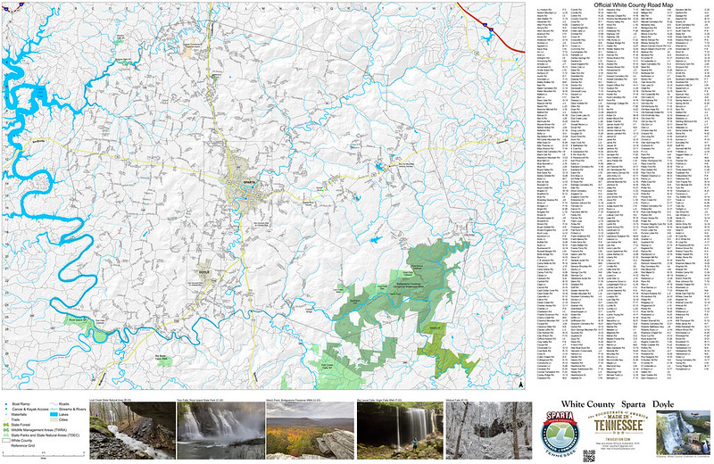
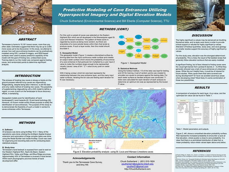
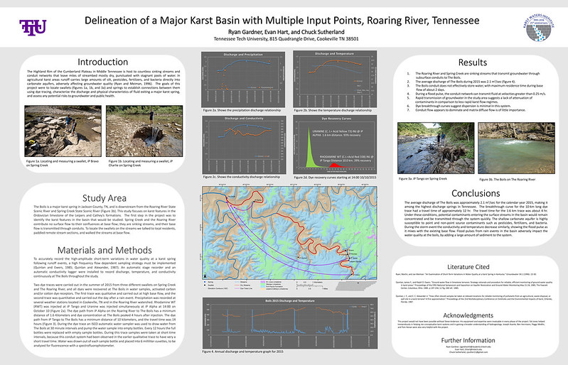
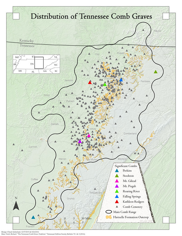
Cartography / Mapping
I am available to create custom maps for projects, events, publications, and scientific journals. I have been making maps professionally since 2012, and have been awarded by my peers in recognition of my work. For a complete list of publications and awards, please see my unofficial CV at http://CV.ChuckSutherland.com.
Please contact me via email at cjsuther21@gmail.com for more information. Examples of some of my maps are below. Follow individual links to learn more about each project.
![Road Map - White County, Tennessee](https://c5.staticflickr.com/8/7187/27049397956_e68b5997eb_c.jpg)
![Predictive Modeling of Cave Entrances Utilizing Hyperspectral Imagery and Digital Elevation Models](https://c1.staticflickr.com/2/1454/25654142304_af0d4fe050_c.jpg)
![Delineation of a Major Karst Basin with Multiple Input Points, Roaring River, Tennessee - Poster](https://c5.staticflickr.com/2/1570/24590643596_d6c88292a8_c.jpg)
![Cummins Falls Marathon 2016](https://c2.staticflickr.com/2/1651/24398277105_ecc27da38a_c.jpg)
![The Tennessee Comb Grave Tradition - Figure 1 color variant](https://c7.staticflickr.com/6/5709/23028348534_6f13d23061_c.jpg)
![Sinkholes in White County, Tennessee](https://c3.staticflickr.com/8/7685/17299007586_1fbfd458b2_c.jpg)
![Whitewater of the Southern Appalachians](https://c2.staticflickr.com/4/3902/15350687705_4e305a2fd1_c.jpg)
![Estimating size-specific brook trout abundance in continuously sampled headwater streams using Bayesian mixed models with zero inflation and overdispersion](https://c2.staticflickr.com/8/7015/6643398401_8b86e87b06_z.jpg)
![Tennessee Cave and Sinkhole Density Map](https://c6.staticflickr.com/3/2835/9825404933_3655465ae0_z.jpg)
Please contact me via email at cjsuther21@gmail.com for more information. Examples of some of my maps are below. Follow individual links to learn more about each project.
![Road Map - White County, Tennessee](https://c5.staticflickr.com/8/7187/27049397956_e68b5997eb_c.jpg)
![Predictive Modeling of Cave Entrances Utilizing Hyperspectral Imagery and Digital Elevation Models](https://c1.staticflickr.com/2/1454/25654142304_af0d4fe050_c.jpg)
![Delineation of a Major Karst Basin with Multiple Input Points, Roaring River, Tennessee - Poster](https://c5.staticflickr.com/2/1570/24590643596_d6c88292a8_c.jpg)
![Cummins Falls Marathon 2016](https://c2.staticflickr.com/2/1651/24398277105_ecc27da38a_c.jpg)
![The Tennessee Comb Grave Tradition - Figure 1 color variant](https://c7.staticflickr.com/6/5709/23028348534_6f13d23061_c.jpg)
![Caves of Kentucky, Tennessee, Alabama, and Georgia (KTAG) 2020](https://live.staticflickr.com/65535/50875573288_6be8820db3_c.jpg)
![Sinkholes in White County, Tennessee](https://c3.staticflickr.com/8/7685/17299007586_1fbfd458b2_c.jpg)
![Whitewater of the Southern Appalachians](https://c2.staticflickr.com/4/3902/15350687705_4e305a2fd1_c.jpg)
![Estimating size-specific brook trout abundance in continuously sampled headwater streams using Bayesian mixed models with zero inflation and overdispersion](https://c2.staticflickr.com/8/7015/6643398401_8b86e87b06_z.jpg)
![Tennessee Cave and Sinkhole Density Map](https://c6.staticflickr.com/3/2835/9825404933_3655465ae0_z.jpg)
Comments