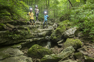
So You're Curious About Caving?

You're curious about caving? It's easy to understand why! Maybe you've seen photographs of caves and you're curious to see these places with your own eyes. Maybe you heard about a friend's excellent adventure through a local cave system and how challenging and rewarding it was for them. Maybe you're looking for the next extreme sport to master or maybe you're interested in learning about history, or a science that's practiced in caves. Whatever your reason, there's a great group of folks who are here to help you on the next leg of your adventure.
"Don't ask where caves are. Ask where cavers are."

|
Gear for Caving in Tennessee |

|
Why We Don't Share Cave Locations |

|
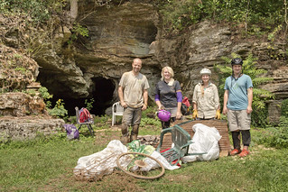
The Role of Grottos in the Caving Community |
|
The Role of Grottos in the Outside Community |
|
Popular posts from this blog
Missing People Map

Sometime around middle to late November of 2019, I started getting tagged in posts on Reddit and Facebook where a map purported to show a correlation between missing person cases and caves. The two maps in question were of terrible quality in both content and image quality (so very much JPG compression). Somehow these maps managed to capture the public's attention for several weeks. In fact, more than two months later I am still being asked questions about the map. What follows is a critical analysis of the maps from both a cartographer's perspective, as well as a caver's. Origin Where did each image come from that comprised the map? The top image is titled " North America Cluster Map " and is produced by the Canam Missing Project / Missing 411. I cannot comment on the methods used to produce the map since they aren't stated. For this reason I am immediately suspect that this is conveying real information. I'll touch on why the form of this ma...
Jungle Book Film (1994) and the Upper Cumberland

Table of Contents The Story David Starnes's Photos April Moore's Photos Watch Guide for Locals THE STORY BEHIND WALT DISNEY'S DECISION TO FILM RUDYARD KIPLING'S JUNGLE BOOK MOVIE AT LOST CREEK CAVE AND WATERFALL A PERSONAL RECOLLECTION BY DAVID STARNES RETIRED PRINCIPAL PLANNER LOCAL PLANNING ASSISTANCE OFFICE TENNESSEE DEPARTMENT OF ECONOMIC AND COMMUNITY DEVELOPMENT I was employed by the State of Tennessee as a community planner from October 1990 to August 2011. The Local Planning Assistance Office of the Upper Cumberland region was based in Cookeville. Our agency was in the Tennessee Department of Economic and Community Development, which also included the Tennessee Film Commission. Occasionally, different agencies would meet to explain their role in fostering economic growth in the state, and this was how my love for caving became entwined in the 1994 Walt Disney live-actio...
The Cumberland Plateau

Table of Contents Part 1 - Geology How it got here Crossbedding Fossils Liesegang Rings Minerals Sandstone as a Resource Tafoni Part 2 - Geography Natural Arches Overlooks Rivers Rock Shelters Slot Canyons / Caves Rock Towns Waterfalls Regional Geology Presentation (2 hours) Part 1 - Geology How it got here About 325 - 260 million years ago, a mountain building event, called the Alleghanian orogeny happened as a result of the collision of the North America and Africa continental plates. The Cumberland Plateau represents the least deformed and westernmost region affected by this event. The Cumberland Plateau is defined by Pennsylvanian sandstones. The Pennsylvanian sandstones are often referred to as "caprock" by geologists because they lie atop the more easily weathered Mississippian sedimentary rocks and provide a protective roof. The Plateau is known for many unique physical features, as well as i...
Comments