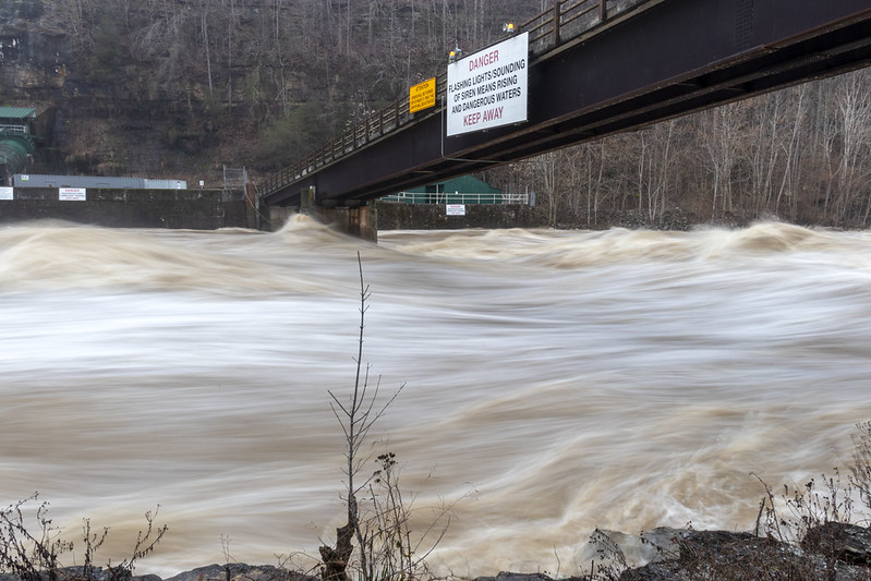
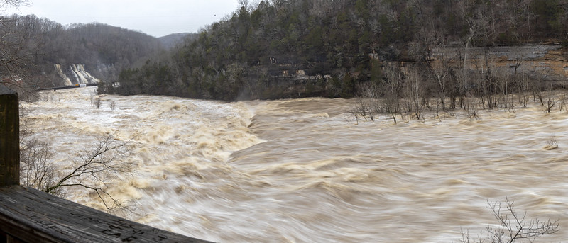
2020/02/06 - Rock Island State Park Flooding
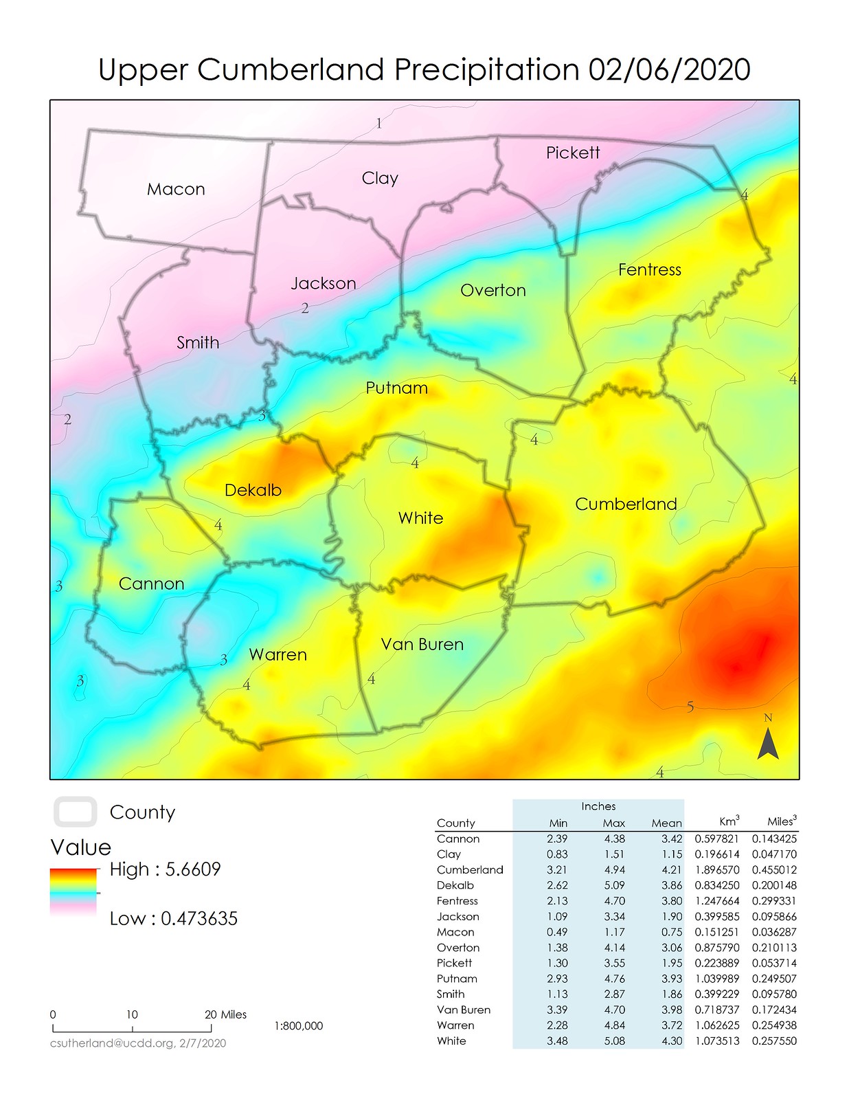
February 6th, 2020 the Upper Cumberland received a lot of rain. So much so, that it was worth a few minutes to whip up a map to help visualize how much. White and Cumberland Counties got the lion's share with 4.30 and 4.21 inches of rain on average across each county, respectively. A more detailed breakdown of the rain is below, along with some dramatic images and videos taken mostly at Rock Island State Park in Warren and White Counties.
Using lidar to estimate normal and flood stage conditions witnessed yesterday, I suspect the water was nearly 30' above its normal stage. Normal stage is approximately 651' FASL, and the cliff edges being nearly inundated are at 681' FASL.

All Flickr Photo and Videos: https://www.flickr.com/photos/chucksutherland/albums/72157713005510572
Using lidar to estimate normal and flood stage conditions witnessed yesterday, I suspect the water was nearly 30' above its normal stage. Normal stage is approximately 651' FASL, and the cliff edges being nearly inundated are at 681' FASL.
All Flickr Photo and Videos: https://www.flickr.com/photos/chucksutherland/albums/72157713005510572


Comments