The Cumberland Plateau
Part 1 - Geology
How it got here
About 325 - 260 million years ago, a mountain building event, called the Alleghanian orogeny happened as a result of the collision of the North America and Africa continental plates. The Cumberland Plateau represents the least deformed and westernmost region affected by this event.
The Cumberland Plateau is defined by Pennsylvanian sandstones. The Pennsylvanian sandstones are often referred to as "caprock" by geologists because they lie atop the more easily weathered Mississippian sedimentary rocks and provide a protective roof.
The Plateau is known for many unique physical features, as well as its notably biodiverse rivers and streams. In this blog post I will explore some of my favorite Cumberland Plateau physical features, and discuss a little about their geomorphology.
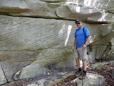
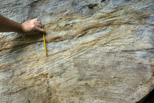
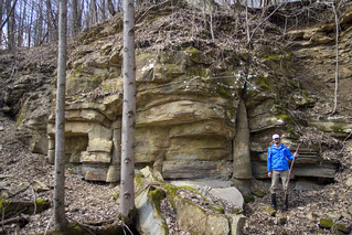
Crossbedding
The diagonal lines encased by horizontal lines in these two photos are crossbeds. They are ancient sand dunes and the sloping lines are the receding limbs of the dunes on what was once a sandy coastal plain. The picture from the lower right (Rockcastle Conglomerate crossbedding) also shows more coarse gravels in the matrix, which suggests a higher energy environment than purely aeolian (wind). It was likely a river, or even a tidal environment.
You can find crossbedding in most of the sandstone outcrops on the Cumberland Plateau, and even in some of the limestones of the Eastern Highland Rim, especially the Warsaw Limestone.
Read more about it here: https://en.wikipedia.org/wiki/Cross-bedding
Fossils
The Cumberland Plateau's sediments were deposited during the Pennsylvanian (Carboniferous for those of you not in the Americas). During that time, vast forests covered the continents. Those forests would later become coal, and on occasion, fossils, which we find in a handful of places on the Cumberland Plateau.
Fossils are more prevalent on the eastern flank of the Cumberland Plateau (Walden Ridge). If you are in that area, find shale beds and look carefully. Lepidodendron fossils are easy to find!
Read more about fossils here: http://www.dcnr.state.pa.us/cs/groups/public/documents/document/dcnr_014599.pdf
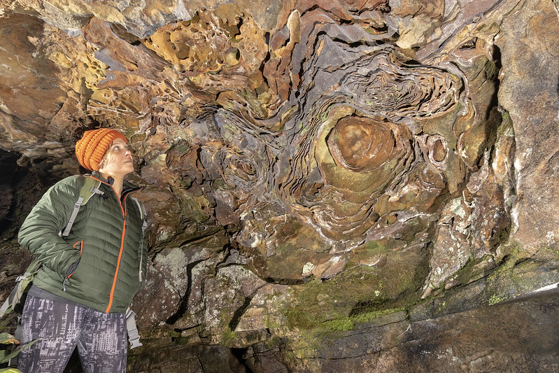
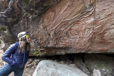
Liesegang Rings
Liesegang rings are often visible on the underside of cliffs and rock shelters of the Cumberland Plateau. They appear as iron-rich extruded ribbons from the surface of the stone. They are slightly more erosion resistant due to their high iron content, and the softer adjacent rock will weather away more quickly, resulting in the extruded surface.
I have noted that liesegang rings are more common the further north one goes along the Cumberland Plateau, with places like the Big South Fork NRRA, or the Daniel Boone National Forest in Kentucky having lots of examples.
Read more about it here: https://en.wikipedia.org/wiki/Liesegang_rings_(geology)
Minerals
Hematite, and limonite are both found in places, in varying qualities on the Cumberland Plateau. But the mineral that is most known of and sought after in the region is coal.
Coal is found in seams which follow the bedding planes of the local strata, which are generally horizontal. Low quality hematite tends to be found more frequently on the southern reaches of the Plateau, at places like the aptly named, South Pittsburgh.


Sandstone as a Resource
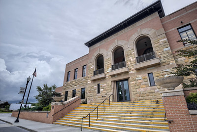
Sandstone has been used historically as long as records have been kept on the Cumberland Plateau. Early settlers immediately recognized its use in construction. Specific types of sandstone, like the world famous Crab Orchard, are quarried on the plateau for use in construction.
Many places on the Plateau employ sandstone construction, with one of the more spectacular examples of it being the Art Circle Library in Crossville (pictured below).
Read more about it here: https://en.wikipedia.org/wiki/Sandstone
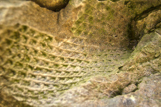
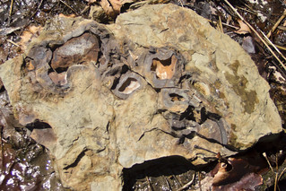
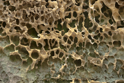
Tafoni
These small cave-like features often occupy the underside of a cliff or a rock shelter. These shapes form on rocks in all manner of environments. While it's not exactly understood how they form on the sandstones of the Cumberland Plateau, it's certain that water moving through the porous medium of the rock plays some role in it.
Tafoni can often be found adjacent to liesegang rings, and is very common in the Big South Fork NRRA.
Read more about it here: https://en.wikipedia.org/wiki/Tafoni

Part 2 - Geography
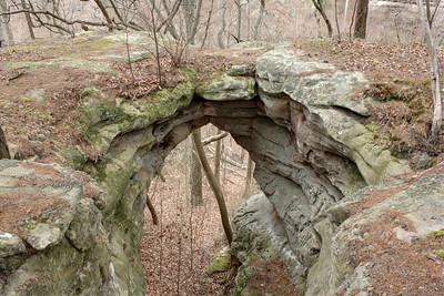
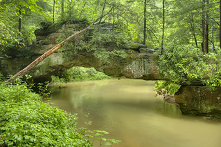
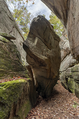
Natural Arches
One of the most spectacular features of the Cumberland Plateau, natural arches occur on ridges and cliffsides as the result of differential weathering along a cliff face.
While each arch has a slightly different story, the general rule is that the sandstone cliffs here erode from the base, not uniformly along their vertical face (see Rock Shelters). Many cliff faces have joints which run parallel to the cliff face, and when the erosion process finds that joint it can create an arch.
Tom Dunigan's Tennessee Landforms is a great resource for finding out more about where you can find these amazing features.
Read more about it here: https://en.wikipedia.org/wiki/Natural_arch


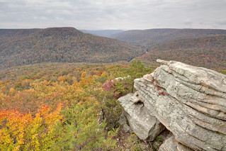
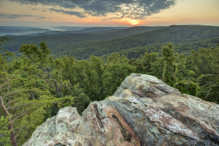
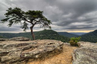
Overlooks
The rule of a good overlook is that the cliff its on must be higher than the trees below it, lest your view be obscured. There are dozens of great overlooks, many of them on private property on the Cumberland Plateau. If you're unsure of where to find a great overlook, try Buzzards Roost in Fall Creek Falls State Park, or& Welch Point in the Bridgestone Firestone Centennial Wilderness WMA.

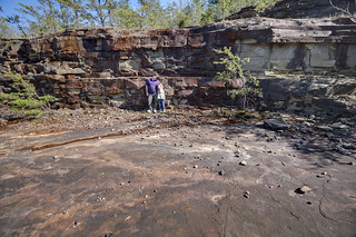
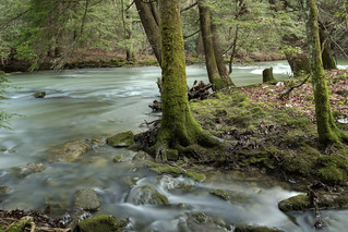
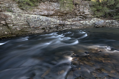
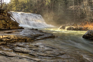
Rivers
The rivers of the Cumberland Plateau are beautiful, rugged, and full of life. They are internationally recognized for their biodiversity, especially with regard to their fish and mollusk populations.
It is also pretty neat that the Emory River flows through an ancient fault line here.
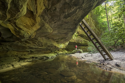


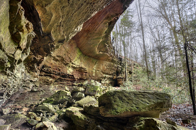
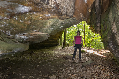
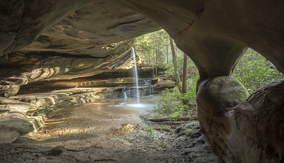
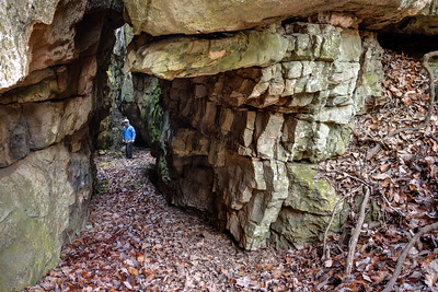
Rock Shelters
Rock shelters are natural caves or overhangs that are formed by the erosion of sandstone cliffs. In the area of the Big South Fork, and Pickett State Park, cliffs tend to erode from their base and develop over time into rock shelters. These features are relatively common on the Cumberland Plateau. Rock shelters provide shelter from the elements and have been used by humans for thousands of years.
There are many different types of rock shelters on the Cumberland Plateau. Some are small and shallow, while others are large and deep. Some are open to the sky, while others are partially or completely enclosed. They are often associated with natural arches.
Rock shelters are home to a variety of plants and animals. Some of the plants that grow in rock shelters include ferns, mosses, and wildflowers. Some of the animals that live in rock shelters include bats, birds, and small mammals.
Rock shelters are important archaeological sites. They have been used by humans for thousands of years, and they contain a wealth of information about human history. Archaeologists have found evidence of human habitation in rock shelters dating back to the Paleoindian period. They have also found evidence of human activity in rock shelters from the Archaic, Woodland, and Mississippian periods. It is important to leave these sites as we find them so as to not disturb the site. Context is very important in archaeology, and we want our future archaeologists to be working with the very best information. Digging, or "pot hunting" is illegal on public lands, and generally unethical in rock shelters unless under the supervision of an archaeologist.
Rock shelters are also important geological sites. They provide insights into the history of the Cumberland Plateau and the surrounding area. Geologists have studied rock shelters to learn about the formation of the plateau, the history of the climate, and the evolution of the plants and animals that live in the area.
Rock shelters are a valuable part of the natural and cultural heritage of the Cumberland Plateau. They provide a glimpse into the past and offer a unique opportunity to experience the beauty of the natural world.

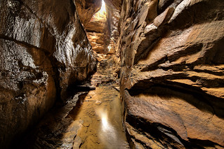
Slot Canyons / Caves
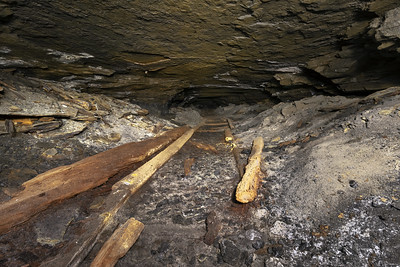
What? Caves in sandstone? Not really. The difference between a cave, an arch, or a slot canyon on the Cumberland Plateau is both a matter of semantics, as well as chance that organic debris and sediment have managed to make a "roof" above a slot canyon, as is the case through most of Devils Cave in the Big South Fork NRRA.
In other places along the rim of the Plateau, large joints have opened as a result of erosion, or perhaps they have been undermined by a deep cave system in the Mississippian limestones below.

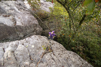
Rock Towns
Rock towns are the informal designation to large boulder strewn fields with slots, caves, arches, shelters, and other overhangs. A handful of these places exist, like Black Mountain, or Zahnd, and a handful more mostly on private property. They are ideal locations for rock climbers to boulder and climb, and are often beautiful photographic destinations.
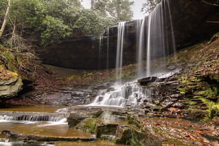
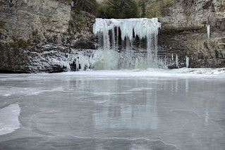
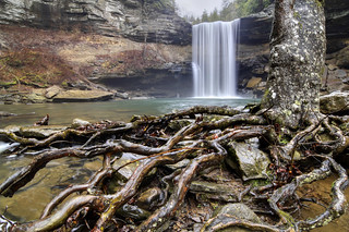
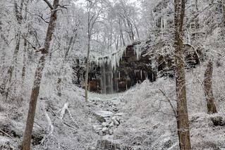
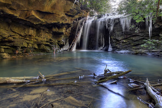
Waterfalls
The Cumberland Plateau has plenty of them. Tom Dunigan's Tennessee Landforms is a good resource for finding (and sharing!) waterfalls. Another great resource is Greg Plumb's Waterfalls of Tennessee.


Comments