Standing Stone State Park and State Forest
For the purpose of this blog post I will be treating Standing Stone State Park and Standing Stone State Forest as a single entity. However, they are distinct, and are managed by different entities with different objectives. Both the State Park and State Forest are located entirely within Overton County, Tennessee about 10 miles northwest of the city of Livingston.
Fullscreen map.
Standing Stone State Park is approximately 1000 acres surrounding Standing Stone Lake. It is itself surrounded by 8000 acres of State Forest of the same name. The park is a celebration of the efforts of the Civilian Conservation Corp (CCC). The large earthwork dam is made of hewn sandstone.
Being a State Park, this area is managed for recreation. Camping there is popular at their rustic cabins. Most people come for hiking trails, fishing, and for paddle boats or kayaking on the small lake.
There seems to be a degree of confusion as to the meaning of a State Forest designation. Land management on State Forests often attract criticism due to this misunderstanding. Taken from their own website, this is their stated objective:
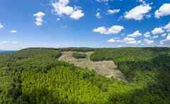
Further the criticism they often draw is due to clearcuts. This is what they have to say about that:
Often, but not always the Division of Forestry shares some management responsibilities with Tennessee Wildlife Resources Agency (TWRA) and the State Forest will allow licensed hunting and fishing. This is the case at the Standing Stone State Forest. For questions on hunting seasons, please consult this Summary of Tennessee Hunting and Trapping Season Dates.
Standing Stone is nestled within the lower elevations of the Eastern Highland Rim and the upper elevations of the Nashville Basin, as defined by geologic context. Its landscape is defined by rolling to steep hills with few waterfalls and cliffs. The large natural area created by the publicly owned land is a refuge for wildlife, plants, and trees. In all seasons the area shows off the beauty of our region (my own personal favorite season to enjoy Standing Stone is the Spring).
While Standing Stone isn't known for its waterfalls, there are a few noteworthy ones within the park and state forest.
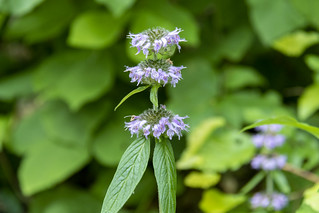
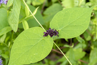
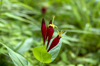
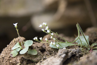
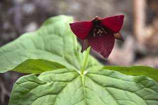
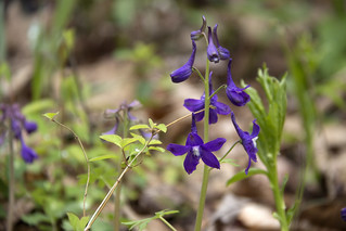
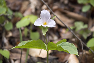
Protection of such a large swath of land has made the wildflower seasons a delight. The sloping hills, with seeps of water at random locations all provide lots of microbiomes for different plant communities to thrive in. Additionally, karst microclimates provide places for plants with cooler preferences.


Official State Forest
Google Map
Tennessee Landforms
Fullscreen map.
Standing Stone State Park
Standing Stone State Park is approximately 1000 acres surrounding Standing Stone Lake. It is itself surrounded by 8000 acres of State Forest of the same name. The park is a celebration of the efforts of the Civilian Conservation Corp (CCC). The large earthwork dam is made of hewn sandstone.
Being a State Park, this area is managed for recreation. Camping there is popular at their rustic cabins. Most people come for hiking trails, fishing, and for paddle boats or kayaking on the small lake.
Standing Stone State Forest
There seems to be a degree of confusion as to the meaning of a State Forest designation. Land management on State Forests often attract criticism due to this misunderstanding. Taken from their own website, this is their stated objective:
The Tennessee Department of Agriculture Division of Forestry has been protecting, conserving, and enhancing our state’s forest resources for over 100 years. The Tennessee Division of Forestry extinguishes 1,000 fires that burn 20,000 acres each year and helps control the disease and insect pests that plague our forests. It provides professional, timely, up-to-date, science-based technical and financial assistance to family forest landowners, communities, non-government organizations, forest industry, and others with an interest in the conservation of Tennessee’s forests.
Further the criticism they often draw is due to clearcuts. This is what they have to say about that:
Clearcutting is a forest regeneration technique that creates wide, open spaces with lots of sun exposure. This allows the most sunlight to reach tree seedlings that require full-sun conditions to thrive. Clearcutting also creates forest clearings that are habitat for various wildlife species.
Often, but not always the Division of Forestry shares some management responsibilities with Tennessee Wildlife Resources Agency (TWRA) and the State Forest will allow licensed hunting and fishing. This is the case at the Standing Stone State Forest. For questions on hunting seasons, please consult this Summary of Tennessee Hunting and Trapping Season Dates.
Geography & Geology
Standing Stone is nestled within the lower elevations of the Eastern Highland Rim and the upper elevations of the Nashville Basin, as defined by geologic context. Its landscape is defined by rolling to steep hills with few waterfalls and cliffs. The large natural area created by the publicly owned land is a refuge for wildlife, plants, and trees. In all seasons the area shows off the beauty of our region (my own personal favorite season to enjoy Standing Stone is the Spring).
Waterfalls
While Standing Stone isn't known for its waterfalls, there are a few noteworthy ones within the park and state forest.
Botany
Protection of such a large swath of land has made the wildflower seasons a delight. The sloping hills, with seeps of water at random locations all provide lots of microbiomes for different plant communities to thrive in. Additionally, karst microclimates provide places for plants with cooler preferences.


Further Resources
Waterfalls and Wildflowers at Standing Stone
Public Lands of the Upper Cumberland
Tri-fold brochure for Standing Stone State Forest
Official State ParkPublic Lands of the Upper Cumberland
Tri-fold brochure for Standing Stone State Forest
Official State Forest
Google Map
Tennessee Landforms
Comments